Europe’s Intelligent Parking Companion for Bus & Truck Drivers
Welcome to the definitive parking solution engineered exclusively for professional commercial drivers
BusTruckPark (short name: BT Park) is a modern, professional-grade mobile app specifically built for bus and truck drivers who need reliable parking and restriction information across Europe. Unlike other solutions, it combines bus parking, truck parking, and critical road data into one clear and easy-to-use platform.
By leveraging high-performance mapping technologies like OpenStreetMap (OSM) and Leaflet, BT Park delivers one of the fastest and most reliable tools in the logistics industry. Whether you are searching for dedicated HGV parking near me or specialized coach parking near major European transit hubs, our platform processes live data instantly to show you the best routes and stops.
With dedicated maps, BT Park transforms complex route planning into a seamless, stress-free experience by delivering real-time GPS positioning, vehicle-specific parking data and direct navigation through Google Maps across Europe with unmatched clarity and precision.
Completely free-to-use and built for professional bus and truck drivers, BT Park serves as your digital co-pilot, ensuring you spend less time searching for parking and more time focused on the road ahead.
About BT Park
BusTruckPark is built for professional drivers, logistics companies, and tour operators
All-in-One Parking Solution for Buses and Trucks
BusTruckPark is the only platform in Europe that combines bus parking, truck parking and road restriction data into one simple and powerful system — completely free.
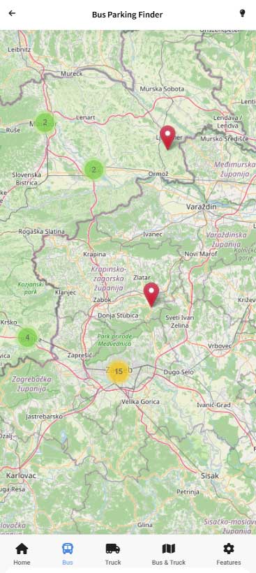
- Bus Map: Red pins for tourist bus parking locations.
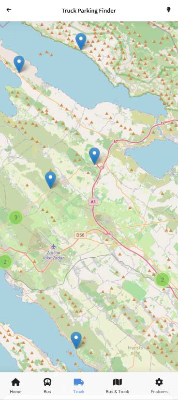
- Truck Map: Blue pins for truck parking and rest areas.
- Combined Map: Full overview for both vehicle types.
- Restrictions: Black pins for height and weight limits.
Quickly search parking by city or street, explore maps with real-time GPS positioning, and navigate instantly using Google Maps.
Designed for real-world driving conditions, BusTruckPark helps you save time, avoid restrictions, and find the right parking without guesswork.
BT Park dedicated maps
BusTruckPark using Leaflet and OpenStreetMap for maximum reliability, designed to give users full control depending on their vehicle type and needs
Bus Parking Map
Designed specifically for the tourism sector, our red pins indicate facilities capable of handling the larger dimensions of tour coaches. We prioritize locations near city landmarks and transit hubs, ensuring passengers can be dropped off and picked up safely while the bus remains in a legal, designated zone.
Truck Parking Map
Our truck-specific data (Blue pins) focuses on the logistics corridors of Europe. These locations include detailed information about on-site services, such as shower facilities, security levels, and proximity to major industrial zones, helping HGV drivers stay compliant with tachograph regulations.
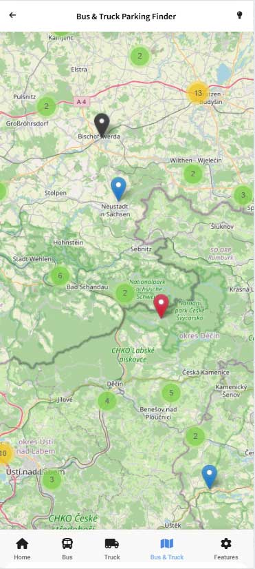
Combined Map
The combined view is essential for fleet managers and mixed-vehicle operators. By integrating black pins for height and weight restrictions directly into the parking view, we provide a 'Safety-First' layer that prevents drivers from planning routes through low bridges or weight-restricted bridges.
Features
Powerful tools designed for smarter, safer driving
Smart Parking Search
Finding the right spot should never be a matter of guesswork when you are on a tight schedule. The BT Park Smart Parking Search is an advanced, high-performance search module that allows you to scan the map by city, street name, or specific address. Instead of making you switch between different modes, our unified engine processes your query instantly and delivers results for both vehicle classes in a single, organized view.
To ensure maximum visual clarity and lightning-fast decision-making, results are distinctively color-coded. Bus parking options are prominently highlighted with a Bus label in red, while heavy goods vehicle options feature a Truck label in blue. Each individual result comes equipped with a dedicated “View Map” button in its respective color (red or blue). With a single tap, the app takes you directly to the exact location on the interactive map.
Read More
Limitations
Safety and regulatory compliance are critical when operating large commercial vehicles. Entering a street with low clearances or driving on a road with weight limits can lead to severe vehicle damage, heavy fines, and operational delays. BT Park solves this problem with a dedicated Limitations search, a proactive tool designed specifically to prevent these dangerous scenarios.
By entering your destination or current route into the search, you can immediately identify any active height or weight restrictions in the area. All restricted spots are clearly indicated with black pins—matching the visual logic used on our primary maps—and include a black “View Map” button. This complete alignment of colors across our maps ensures you can spot hazards instantly and adjust your route before you even start driving.
Read More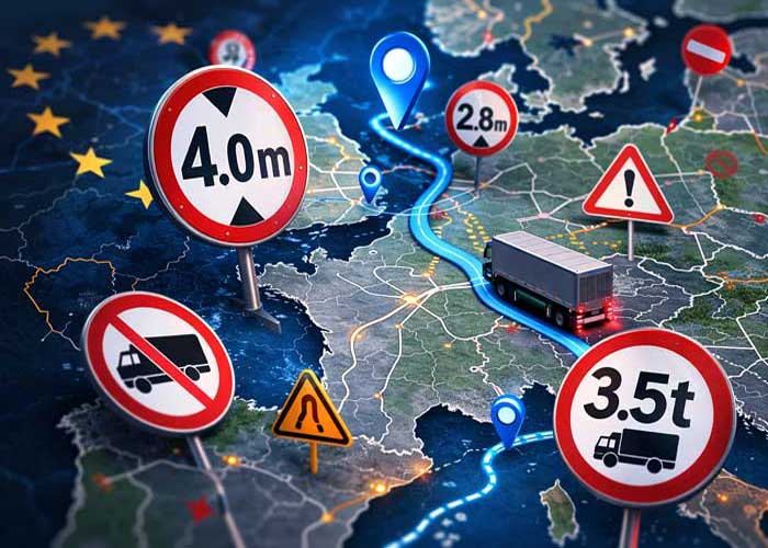
GeoSwiftSOS – Emergency Location Sharing
Safety in the transport industry is not just about where you park; it is about being fully prepared for the unexpected. **GeoSwiftSOS** is our proprietary emergency response feature that bridges the gap when technology fails. If you find yourself in a dead zone or involved in a mechanical failure where internet access is unavailable, GeoSwiftSOS allows you to broadcast your precise coordinates via encrypted SMS protocols.
This ensures your dispatchers, company contacts, or emergency services can locate your vehicle with sub-meter precision. It is a completely independent, lightweight tool that runs locally on your device, never connects to external servers, and prioritizes driver life-safety above all else. This feature provides ultimate peace of mind when navigating remote roads or driving across international borders.
Read More
Contact & Feedback
At BusTruckPark, we believe that the best logistics tools are built through active collaboration with the professional driving community. Roads change, new parking areas open, and driver requirements evolve. That is why our features section includes a dedicated **Contact and Feedback Hub** designed to give you a direct line of communication with our team.
We have made it incredibly simple to send us your suggestions, report changed parking data, or submit ideas directly to our development team. Whether you want to request help or suggest a new spot you have discovered, we read every submission. Your real-world insights directly influence our software updates, making BT Park a more accurate and powerful navigation companion for every driver across Europe.
Read More
Start using BusTruckPark today
Find parking faster, avoid restrictions, and navigate with confidence across Europe.
Services
Everything a professional driver needs in one beautifully designed app
Combined Map
Red pins for buses, blue for trucks, black for height & weight restrictions – all in one view.
Why Professional Drivers Choose BusTruckPark (BT Park)
Clear Color Coding
Red for buses, blue for trucks, black for restrictions – instant visual understanding
Europe-Wide Coverage
Comprehensive parking database for buses and trucks across the entire continent
Safety First
Detailed limitations, services, and the powerful offline GeoSwiftSOS emergency tool
Specifically designed for bus and truck drivers across Europe
One-tap Google Maps navigation
Detailed parking information (capacity, price, services, limitations)
Smart search functionality for fast results
Dark mode support for night driving
Regularly updated parking database
Simple, driver-friendly interface
Integrated GeoSwiftSOS emergency feature
Available on Google Play • Completely Free
Frequently Asked Questions
-
Is BT Park really free?
Yes. The entire app including all maps, search, and detailed information is completely free with no hidden fees.
-
Which countries does BusTruckPark cover?
BusTruckPark covers Europe, including all EU countries and major international traffic routes across the European continent.
-
Do I need an internet connection to use BT Park?
An internet connection is required for the initial data load, which is then cached on your device. You can use the data stored in this way, but we recommend an internet connection for the most up-to-date data and for Google Maps navigation.
-
How do I navigate to a parking location?
Simply tap the Navigate button on any parking location, and BT Park will open Google Maps with full turn-by-turn directions directly to that spot.
-
How detailed is the parking information?
Each parking location in BusTruckPark shows the type, capacity, price, on-site services (for trucks), height and weight limitations (for buses), GPS coordinates, and a direct navigation button.
-
Are all parking locations verified?
Yes, all parking locations and restrictions have been verified by official sources, but due to possible changes, it is necessary to follow official notices from local authorities.
-
How accurate are the height and weight restrictions?
BusTruckPark uses verified logistical data for all height and weight restrictions. We always recommend following official road signs as conditions may change due to construction or local regulation updates.
Contact
Have questions, suggestions, need support or found a new parking spot? Let us know!